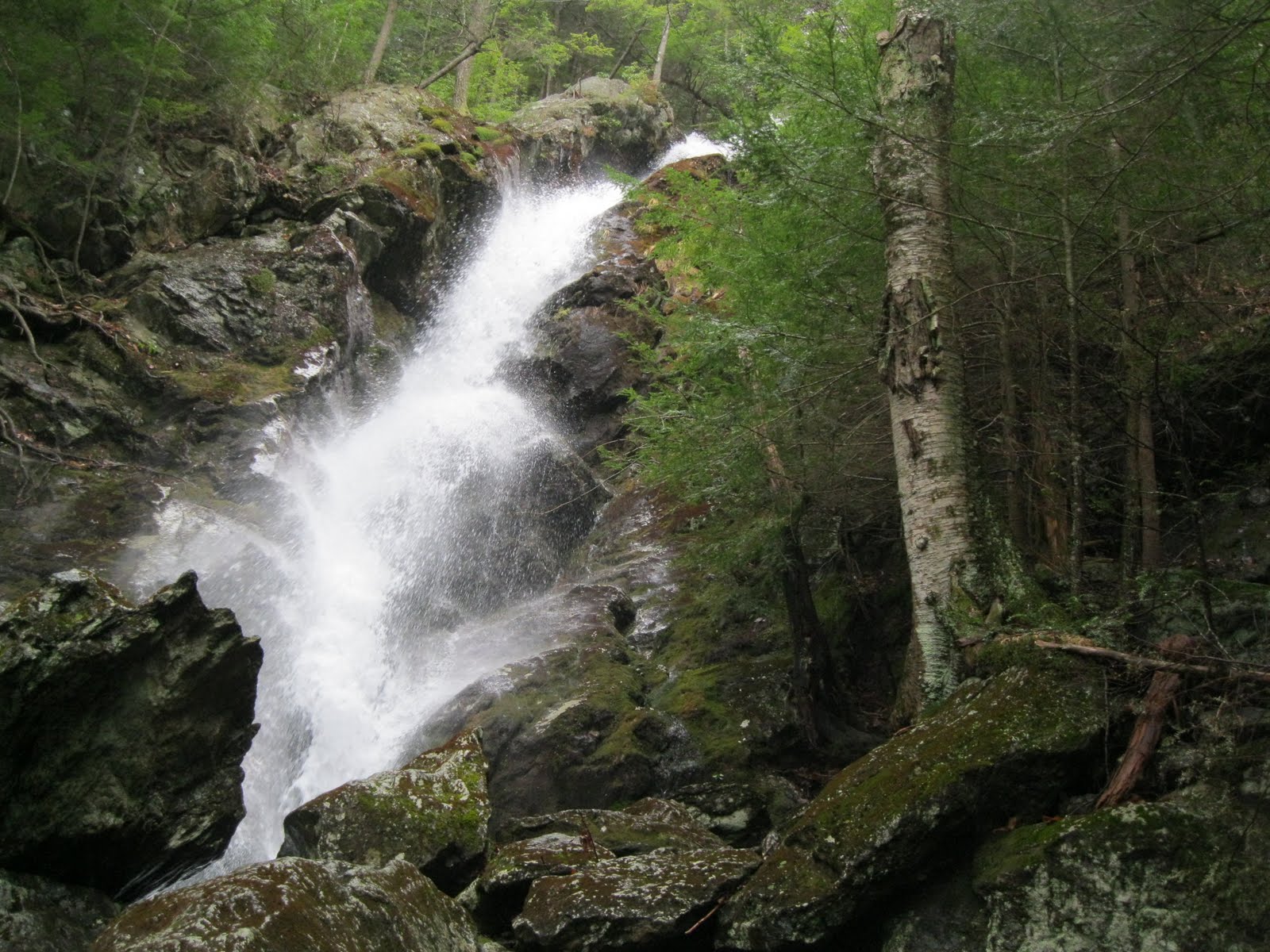
BSA Troop 494 went on a two day, one night, excursion along the Appalachian Trail starting in Salisbury, CT, and ending over the boarder in MA. We started up the Undercliff Trail to the AT and took that up to the summit of Bear Mountain where we took a long rest and had some lunch. There was a large pile of rocks there (don't ask me why) and a plaque at the base of it claiming Bear Mountain to be the tallest point in CT. The view there was beautiful and you could see for miles. After summiting, we took a dreadful trail down some really steep and slippery rocks. Everyone slipped and fell at least once because there was no such thing as dry trail, given it had rained the two previous days. Once that ordeal was over, we found a Laural Brook Campsite, which isn't the campsite where we wanted to spend the night, but where we wanted to stay was actually a little further down the trail. Once we got there, we learned that the campsite had been relocated to the previous location. We now know that our maps are out of date. Anyway, we decided that since we had about 3 more hours of good daylight, we might as well make the three more mile trip to the next campsite, the Bear Falls campsite. And, just as soon as we decided to make the extra 3 miles, it started to rain. Not bad, just some passing sprinkles, but its still rain. To get there, we had to cross a river that was flowing over the trail and required removal of shoes and socks and to cross freezing cold, shin deep, water. THEN, we had to summit Race Mountain, which was not as tall as Bear Mountain, but its still a mountain. Afterward, we did a nice cliff walk along the mountain ridge on about a two foot wide trail with a thousand foot drop to the right and woods to the left. After trudging through the mud, we finally made it the campsite, after what felt like for ever. That was a 15 mile ordeal. That's impressive, with a group of 12, each with a 30 pack. After a small mishap with one of the stoves, we cooked some soup for dinner and got some well deserved sleep. We woke up the next morning to a little more rain, but with a real easy hike out, approximately 2 more miles to the parking lot where we staged a car to go back and grab the other at the starting lot. On the way back, we encountered a HUGE waterfall, with about an 80 foot drop, and we all had fun climbing up on the side. All in all, we're very tired, dirty, and we all had a blast.
 |
| Here we are leaving the firehouse at about 8 in the morning |
 |
| Up the slippery rocks toward the top of Bear Mountain |
There were a couple really nice lookout points along the trail to the top of the mountain. Here are some pictures that resulted of those beautiful vistas:
 |
| Here's some of the crew at one lookout |
 |
| Here is the whole crew |
 |
| This is the view atop the great rock pile on the mountain top. |
 |
| Here we are eating lunch |
 |
| The crew on the summit |
 |
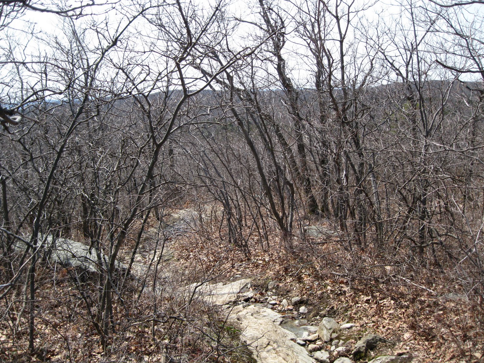
| The tallest hill out there is Mt. Everett, the tallest mountain in the area. We climbed that a couple of years ago and it was a lot of fun. The lower hill just to the right I believe is Race Mountain, our second summit of the day. That's pretty far out there. |
 |
| The plaque stating that this is the tallest point in CT. It's too bad you can't read it |
 |
| Here we are climbing down the slipper rocks. Good thing we decided to start where we did rather than start where we ended because going up these rocks would be torturous. |
 |
| Slipping down the mountian |
 |
| This was actually the trail. No way around these rocks |
 |
| WAAAAYYY up there is my father climbing down |
 |
| AT signs |
 |
| Us hiking along in Sage's Ravine |
 |
| The pictures really don't do the justice. These rocks and the river are a lot larger than they look. |
 |
| Everywhere there were rivers and waterfalls that led into the main river in the ravine. |
 |
| Ya, there was still snow hanging around |
 |
| Over there's my dad, and next to him is a 30 waterfall. |
 |
| More AT signs. One of which is pointless. |
 |
| The fog rolled in under the mountain, and this is when it began to rain a little. |
 |
| This is the view on top of Race Mountain |
 |
| Chilling on the rocks |
 |
| Here we are on the cliff walk |
 |
| Someone built a pi symbol out of rocks. that's cool |
 |
| That big peak ahead is Mt. Everett. |
 |
| There's Casey coming through the low brush. |
 |
| More AT trail signs. |
 |
| Camp |
 |
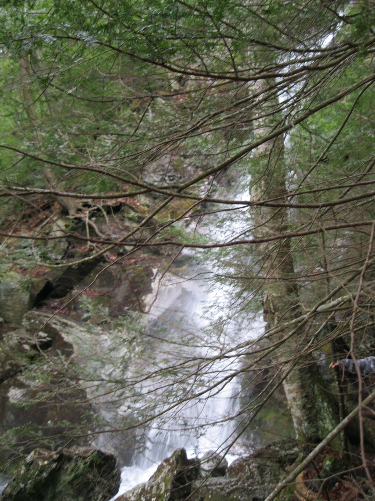
| Here's that 80 foot waterfall. Again, the pictures don't show the sheer size or beauty of the falls. |
 |
| Me...on a rock |
 |
| I took some pictures on my way to the top of the falls. |
 |
| Near the top of the falls |
And after the fun at the waterfall, we uneventfully went back to the parking lot and headed home. It was a lot of fun!